



Empowering communities with real, actionable science.
Listen together. Count for something.
Every Terra Station documents the birds and wildlife at your station around the clock, and its detections feed a continental dataset open to researchers and conservationists.
- Made by Cellular Tracking Technologies, Cape May, NJ
- Wildlife-tracking hardware for researchers since 2009
- 2,500+ stations deployed
- Motus-compatible radio-tag detection
- Volume and education pricing
- 30-day returns
Building a network, one location at a time
You don't need a science degree to contribute to research. A station that is up and listening is already doing the work automatically: logging migration and population data at a scale no human survey can match.
- ✓ Zero-effort data collection
- ✓ Every station expands the Motus radio-tag network — helping track tagged birds, bats, and insects
- ✓ Contribute to conservation in a concrete way
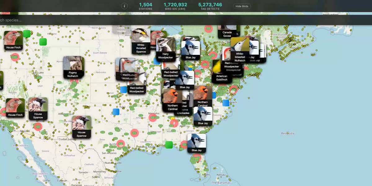
Live detections across the network · Open the live map →
Groundbreaking Monarch Butterfly Data — Terra is There
In 2025, Monarch butterflies released at Cape May Point carried tiny BlūMorpho radio tags across the US and into Mexico. Every Terra Station has a compatible antenna, so as the butterflies moved south, stations in ordinary backyards logged them along the route. The track made the front page of the New York Times.
More than 400 monarchs carried tags in fall 2025, with more each season, and the project is still running. If your station is up and listening, it's already part of it.
The full story →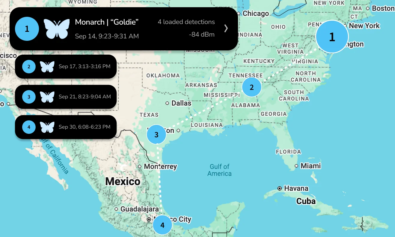
A tagged monarch's journey, as it appears in the Terra app.
Better Together
One station is a data point. A handful, spread across a town or a watershed, is a network. $329 each, with group pricing for 3 or more stations.
Conservation starts with data. In the past that meant professional, long-term surveys. Terra automates that process and arms you with the data you need to defend and preserve your local wild spaces.
Bird clubs
Bring members together to learn more about your area or research a specific question.
Neighborhoods & towns
Protect your wild spaces with real data. A continuous record of the species on a site supports petitions and applications to conserve it, including those made under the Endangered Species Act.
Watershed & conservation groups
Survey your property for every type of wildlife, and document the effects of conservation projects.
How a group project works
Three steps from one station to a shared survey

Create a group
Each member or site gets a Terra. Plug it in, scan the QR code, and it is listening the same night. Then share the Terra with your group, and all the members will be able to see the stations.
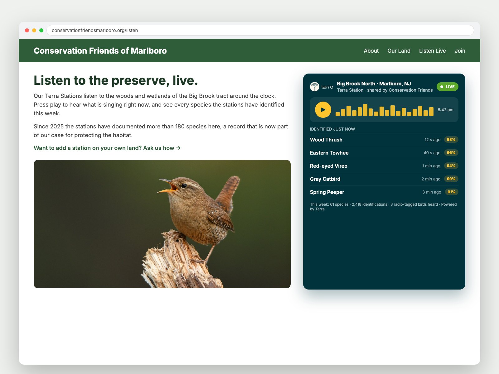
Make them public
Share a station online with the Terra widget, which streams your project directly from your website so the public can learn more or join your project.
Build your case
Gather the data you need for your project and take action.
Become a force for change
Data from Terra projects can be used for reports, newsletters, town meetings or government applications. You'll have a consistent, thorough record of your survey.
Our Partners
Collaborating with world-class conservation organizations


Ready to start listening as a group?
Tell us about your group and your sites, and we will help you scope a deployment and group pricing.
Running an academic or professional study? Terra for research → · Terra for nature centers & lodges →